Your browser doesn't support scripts!
DroneBook
Join or Login
Home
People
Search
Events
Forums
Videos
Photos
Sites
Blogs
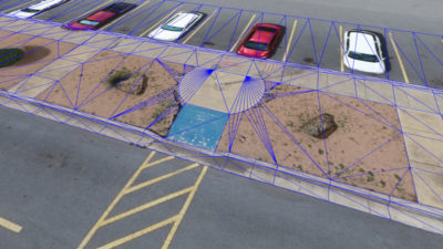
Virtual Surveyor Introduces Curb & Gutter Mapping in New Version of Drone Surveying Software
email
facebook
linkedin
twitter
google+
Image
https://amerisurv.com/2020/11/02/virtual-surveyor-introduces-curb-gutter-mapping-in-new-version-of-drone-surveying-software/
0
votes
166
Description
Virtual-surveyor produces a software application that is designed to turn drone data into CAD models. They have recently released a video about how to build CAD designs for curb and guttering using drone photo data.
Comments
Order by:
oldest first
newest first
expand all
Per page:
…
10
20
50
100
200
There are no comments yet
Information
JAS-Aerial
02.11.2020 (1486 days ago)
Drone News
obd1.02
meta:003.3:picwg:gotvid
Recommend
Are you sure?
Yes
No
Please, enter a value here
OK
Cancel